
3.2 L configurationUp to 3 h
Current compact fuel cycle
Selected when payload, polygon, operating point, reserve and planned service stops fit a shorter sortie.
BlueCap Australia
BlueCap operates three-helicopter BlueCapHeli® survey systems with three pilots for magnetic, LiDAR and radiometric surveys. Two complete teams can be scoped on request for roughly twice the daily magnetic line-km in suitable conditions.

BlueCap-operated airborne carrier · designed in Australia
BlueCapHeli® carries magnetic, LiDAR, radiometric and imaging payloads over large, remote and rugged survey areas.
BlueCap’s standard survey system is three BlueCapHeli® helicopters with three pilots. The aircraft usually fly in parallel; a very small block may use two at once when BlueCap’s operational plan calls for it. Clients purchase the complete survey service rather than selecting an aircraft count. Two complete teams, six helicopters and six pilots in all, can be scoped on request for roughly twice the daily magnetic line-km on a suitable project; the quote and flight plan are assessed separately.
The aircraft, payload, remote pilots, field communications and processing workflow are delivered as one BlueCap survey service. BlueCapHeli® is not sold or leased as standalone equipment. In international specifications, the same fuel class may be described as a gasoline-powered or gas-powered drone helicopter; Australian copy uses petrol.
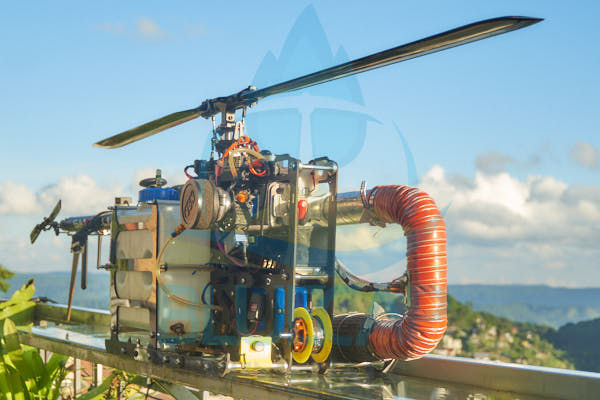
The 3.2 L configuration supports compact survey cycles and quick field service. The 10 L configuration provides additional mission-design margin for remote polygons, long transit legs and extensive production lines. A larger tank is not automatically the better survey plan.
Selected when payload, polygon, operating point, reserve and planned service stops fit a shorter sortie.
Evaluated when distance to the survey block or long production lines would make frequent returns inefficient.
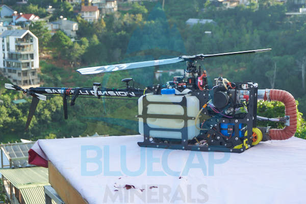
The aircraft is almost two and a half metres long, giving clients a clear physical scale well beyond a typical electric survey multirotor.
Maximum cruise is 140 km/h. For radiometric acquisition BlueCap can hold a stable 20 km/h terrain-relative flight profile when required by the measurement plan.
CASA single-rotor liquid-fuelled helicopter category up to 25 kg; the approved mission configuration remains controlling.
Aircraft mass before fuel, payload and other mission-specific equipment are added.
The upward force measured while the helicopter is held in place. It shows lifting capability; approved take-off mass still sets the usable fuel and payload.
A hybrid onboard power architecture keeps the aircraft battery charged in flight without implying electric rotor propulsion. The flight battery does not need to be removed or charged between fuelled missions.
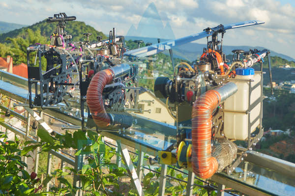
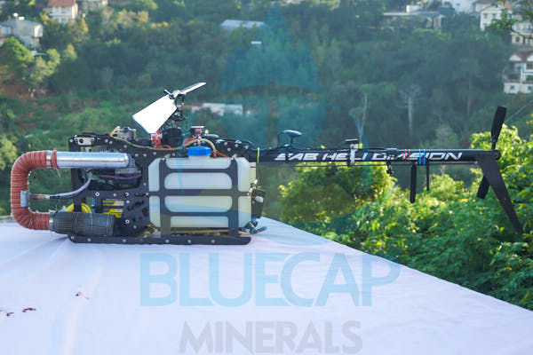
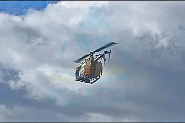
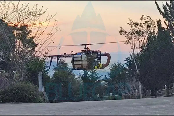
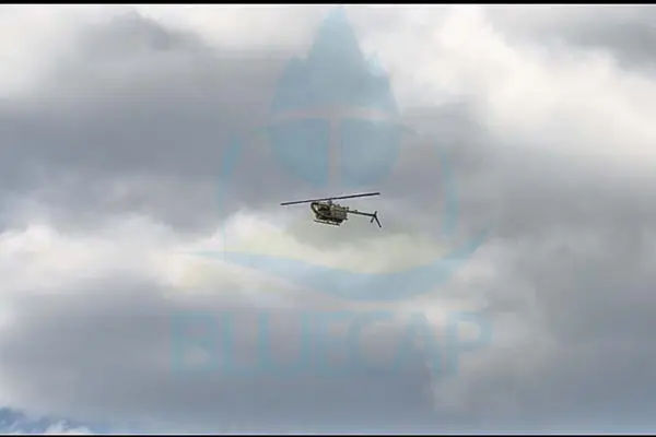
BlueCap designed and developed the platform in Australia between 2023 and 2026 and has manufactured it in-house in Perth, WA since 2025. Each aircraft is configured around the payload, terrain, communications coverage and approved operating plan.
BlueCapHeli® keeps approved-route execution, independent oversight and the direct-radio contingency path distinct.
No user can steer or redirect the helicopter to an arbitrary location. It flies only the route agreed and approved before take-off; authorised intervention is limited to permitted safety actions such as Stop Mission and Return-to-Base.
Authorised aviation regulators and airspace controllers can observe the aircraft in real time, inspect its flight logs and replay recorded missions. Where operational authority requires intervention, approved access can stop the survey mission and initiate Return-to-Base, but never redirect it to an arbitrary destination.
BlueCapHeli® does not rely on a conventional handheld transmitter and does not accept point-and-fly steering. BlueCap pilots supervise the approved mission and issue only permissioned commands through redundant encrypted internet channels, with fingerprint confirmation for critical actions.
A restricted direct-radio controller remains available over approximately 10–15 km line-of-sight. It is not a manual steering handset: in an unforeseen situation it can issue Return-to-Base directly, taking priority over the internet control path.
Survey terrain can change engine conditions by hundreds of metres inside one project. BlueCap built the control response for the climb, descent and changing air density that follow.
BlueCapBird® magnetometers, Medusa gamma spectrometers, BlueCapLidar® and imaging systems are integrated as project configurations.
BlueCapWinch® provides motorised real-time control of a suspended sensor independently of the carrier's immediate vertical motion.
A 9 W aviation-grade high-intensity LED strobe supports operational visibility and the applicable aviation-safety plan.
BlueCap developed an innovative exhaust silencer that substantially reduces the normal acoustic presence of a petrol engine. The result is a long-endurance survey helicopter that remains close to an electric heavy-lift drone in BlueCap's same-condition hover measurement.
BlueCapHeli® with the engineered silencer
DJI Matrice 600 Pro under the same conditions
BlueCap measured both aircraft on the same test basis. These figures are comparative field measurements, not a statutory acoustic certification.
The engineered silencer is integrated into the field airframe to reduce acoustic presence while preserving long-endurance petrol operation.
The quieter exhaust is less intrusive around communities and work crews and avoids a persistent petrol-engine note becoming a nuisance during long survey programmes.
Lower acoustic presence helps reduce avoidable startle and disturbance around livestock and wildlife while the project flight plan retains its site-specific controls.
Lower noise exposure reduces fatigue for pilots, spotters and field personnel working near the operating base across repeated survey sorties.
One BlueCapHeli® survey system comprises three helicopters and three pilots. Two complete teams can be scoped on request for roughly twice the daily magnetic line-km in suitable conditions. Useful line-kilometres still depend on survey geometry, terrain, payload behaviour, weather, approvals and field QC.
The accumulated BlueCapHeli® flight history spans aircraft development, testing, trial programmes and commercial survey operations.
Three helicopters typically acquire 600–800 productive line-km each. Nominal planning is 2,100 per system-day, subject to geometry, payload, terrain, turns, weather, approvals and field QC.
Before a new survey campaign, each helicopter is disassembled, inspected and rebuilt; uncertain or worn components are replaced before deployment.
Flight-ready backup capacity supports continuity when an aircraft needs maintenance or replacement.
Remote pilots monitor aircraft systems, payload behaviour and onboard sensors rather than treating autonomy as unattended operation.
Secure pilot handover and multi-aircraft coordination are supported where staffing, permissions and the approved plan allow them.
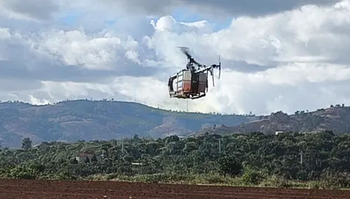
This comparison is based on BlueCap's late-2025 field experiment with the same suspended BlueCapBird® magnetometer. Results from the DJI Matrice 600 and BlueCapHeli® are normalised to one identical 9 × 8 km client deliverable so field duration, aircraft programme time and direct team cost can be compared on the same survey basis.
72 km² · 50 m production-line spacing · 1,440 accepted line-km · eight airborne hours per day · five minutes for each landing, energy service and next take-off.
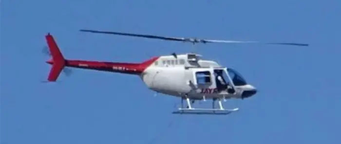
This planning comparison holds survey area and production-line spacing equal. It then compares a Bell 206 crewed helicopter with BlueCapHeli® while keeping their different certification, crew, autonomy, clearance and logistics profiles visible.
Both aircraft can carry 1–3 pT-class magnetometers. Sensitivity alone does not control spatial resolution.
The question is not whether an aircraft can fail. It is how the particular airframe is maintained and tested, what recovery modes remain available, how energy-source hazards are controlled and how people, infrastructure and dry country are protected.
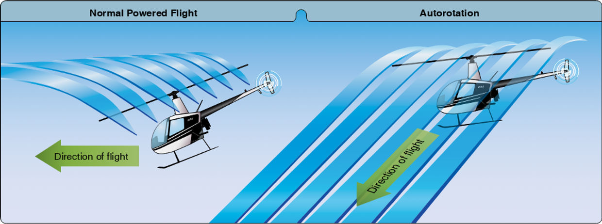
With rotor and flight-control authority available, airflow can keep the rotor turning and retain directional control toward a suitable touchdown area. It reduces descent severity; it does not guarantee an incident-free landing.
Across years of BlueCapHeli® operations, BlueCap has never recorded a helicopter fire. Remote pilots and spotters are trained for fuel and fire response, and spotters carry fire extinguishers in the field. Petrol and Li-Po still require different prevention, isolation and emergency procedures.
Deliberate checks are performed at safe altitude over a prepared area. The aircraft proceeds only after the required modes are verified.
Each project receives a newly built or freshly assembled and tested aircraft rather than an airframe with uncertain component condition.
A deliberate in-flight engine-shutdown procedure is completed before the aircraft is cleared for production work.
Weather, communications, payload behaviour, reserve, landing options and exclusion zones remain explicit reasons to stop or alter a sortie.
The controls support the survey HSE plan; they do not replace CASA permissions, site controls or the risk assessment for the actual project.
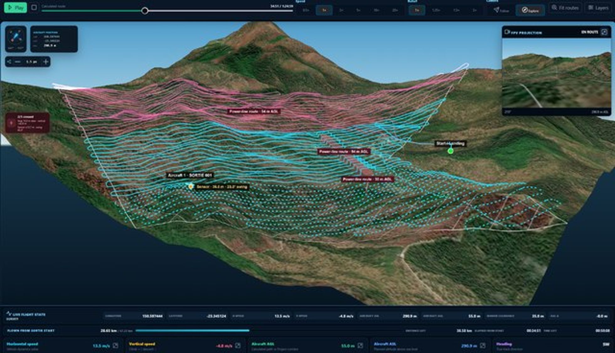
From the first polygon and live quote through 2D/3D mission review, acquisition evidence and trajectory replay.
Related systems: BlueCapBird® quantum magnetometer payload, BlueCapLidar® dual-scanner payload, magnetic survey service and LiDAR survey service.
Press play to see one three-helicopter BlueCapHeli® survey system acquire a schematic block. The counter illustrates a nominal 2,100 productive line-km on a suitable flying day. The aircraft count shown is an explanation of the standard system, not a customer selection.
Three helicopters and three pilots normally operate together. BlueCap sets the aircraft plan; clients do not select an aircraft count.
Project enquiry
Start with your survey area and the data you need. We’ll help define the scope, review terrain-aware 2D and 3D flight plans, and keep field progress, processed data and deliverables together in the BlueCap Survey Portal.
No software subscription fee for BlueCap service projects.
