BlueCap Australia

Bluecap Minerals — Advanced Airborne Geophysics since 2018 Australia

We specialize in drone magnetic surveys and laser terrain mapping to locate Earth’s hidden resources and support mine planning and development — faster, safer, and with higher accuracy.

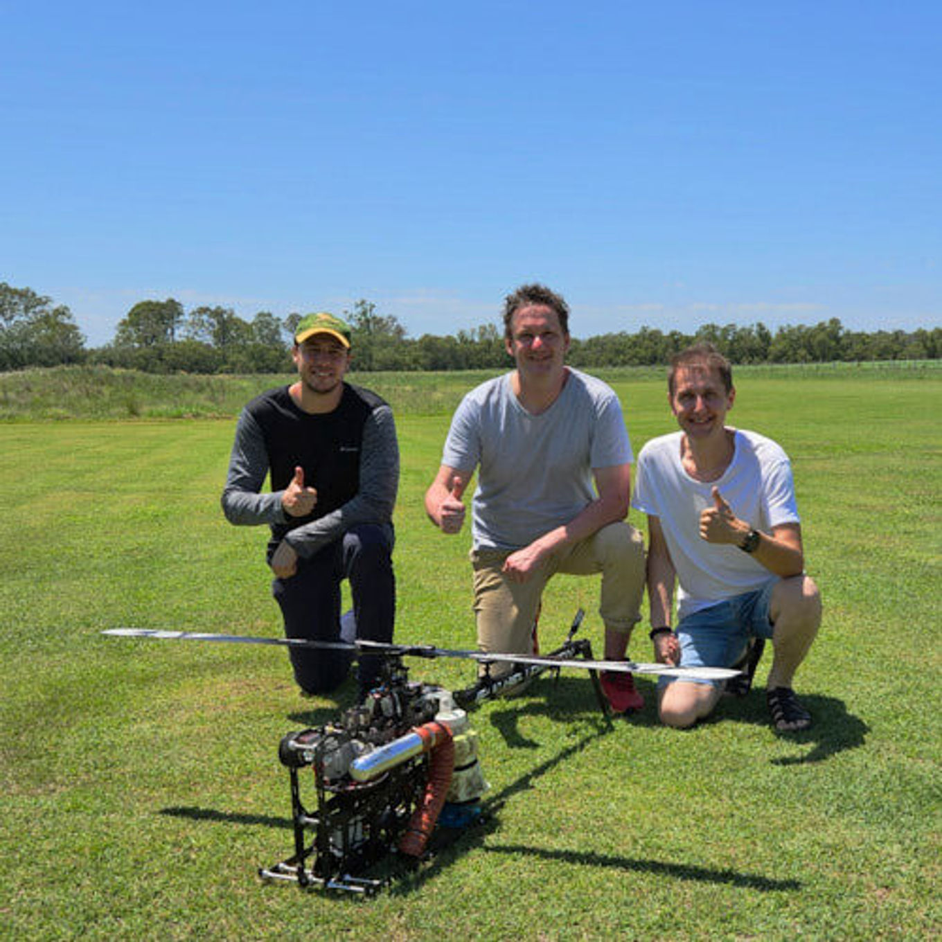
BlueCap remote pilots with BlueCapHeli® during a field deployment in Queensland

We specialize in drone magnetic surveys and laser terrain mapping to locate Earth’s hidden resources and support mine planning and development — faster, safer, and with higher accuracy.

BlueCap is Fully Certified by the Civil Aviation Safety Authority (CASA) for Extreme Airborne Missions

Liquid-fuel helicopter drones 25 kg class

Extended range with spotters (EVLOS)

Approved for night operations

Bluecap Minerals Pty Ltd

Record
Detail
Context
RecordAustralian CompanyDetail670.558.648ContextBluecap Minerals Pty Ltd
RecordAviation ReferenceDetail129.07.61ContextBluecap Minerals Pty Ltd
RecordGold Coast officesDetail26 Cimbrook Way, Duncraig, WA 6023Context21 Crombie Avenue, Bundall, QLD 4217
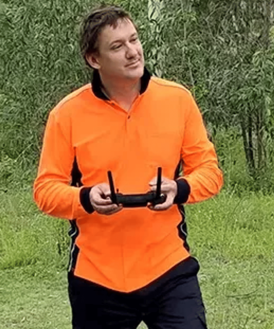
Andrew Musinov, Managing Director of BlueCap Minerals
At Bluecap, we don’t just fly drones — we uncover the Earth’s hidden patterns to help our clients make the right decisions. We built this company to do things differently: with precision, fairness, and a relentless pursuit of clarity. And we’re here to change what’s expected from the sky!
01 / 04
125,000 km
flown on drones

in Australia since 2018

29 times
crossing Australia

on the Indian Pacific route from Sydney to Perth

72 times
Hanoi–Saigon railway

equivalent route distance

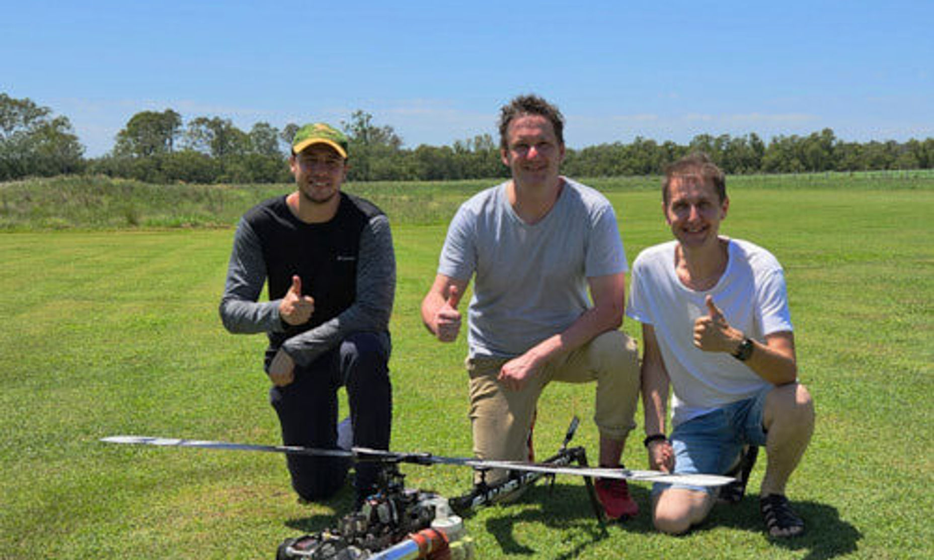
Bluecap remote pilots team

Remote field operations · (QLD, Nov 2025)

We’re one of the few teams still actively delivering drone-based mineral exploration services in challenging operating environments, as many operators have exited the sector. We would be pleased to discuss your exploration program and operational requirements.

Safety & readiness

BlueCap operational personnel maintain certifications in Basic Emergency Life Support, Advanced and Remote Area First Aid, Emergency Medical Response, and Cardiopulmonary Resuscitation (CPR). Field teams are equipped with comprehensive emergency medical kits, remote-area safety equipment, and automated external defibrillators (AEDs) to support extended remote operations and emergency response readiness.

Meet the BlueCap team
Our Niche: Bridging the Gap in Airborne Exploration

Bluecap fills a critical operational and capability gap in the exploration market.

While manned aircraft can cover great distances, their data is coarse and often inconclusive. Electric drones offer high resolution, but are limited in range, endurance, and payload.

We bring the best of both worlds — delivering high-resolution magnetic data across large-scale and remote targets, using our own long-endurance gas helicopters BlueCapHeli® engineered in-house specifically for precision geophysics. This allows us to conduct missions that manned aircraft cannot fly, and that other drones cannot sustain.

**Mountains, highlands, deserts, snowfields, night skies — these aren’t obstacles.
**Challenging topography is our zone of expertise. This is where we do our best work.

We specialize in regions with no prior data, no roads, no communications, no power — and often, no second chances.

Our mission: Exploration That Drives the Energy Transition

Our mission is to accelerate the global discovery of critical minerals that power the energy transition.
We help unlock new deposits of lithium, cobalt, copper, rare earths and more — hidden beneath the Earth’s most remote and challenging terrain.

By delivering high-resolution magnetic data faster, more accurately, and across areas others cannot reach, we empower exploration companies to make confident, data-driven drilling decisions — and avoid costly mistakes.

We believe that airborne geophysics is essential to building a sustainable, electrified future — and we’re here to lead that transformation from the sky.

Specialized, Controlled, and Compliant
  1. Our team has flown over 125,000 km on drones in Australia since 2018:
    – equivalent to crossing Australia on the Indian Pacific route from Sydney to Perth nearly 29 times.
    – equivalent to flying the full **Hanoi–Saigon railway route **more than 72 times.
  2. We provide drone-borne aerial mineral exploration services only. We do not provide unrelated drone services.
  3. Although our team builds specialized UAV/drone systems and sensor integrations in both Australia & Vietnam, we are not a general-purpose drone manufacturer in the consumer sense. Rather, we develop mission-specific aerial systems for mineral exploration, integrating selected third-party components with our own airframe design, onboard software, cloud systems, and ground control infrastructure.
  4. We do not sell, lease, or hand over independent control of our aircraft or survey equipment to third parties. Our equipment is operated only by our own team, and our clients receive a professional survey service — not aircraft access.
  5. We do not participate in defence or military programs.
  6. We operate only lawfully and remain open to cooperation with relevant local authorities in the interests of aviation safety, public confidence, and a peaceful sky. Because we operate large UAV systems in a sovereign country, we maintain strict internal controls, traceability, and operational transparency to protect our team, our clients, and the integrity of every mission.
  7. For this purpose, we maintain accessible records and monitoring tools for authorised government review, including a retained history of operations over the past seven years. These records include: flight telemetry and operational logs,
  8. GPS route history,
  9. relevant sensor data,
  10. time- and location-stamped camera imagery.
  11. Our team builds the same specialized aircraft platform for mineral exploration across different jurisdictions, including Australia and Vietnam, with each system tailored to meet local legal, safety, and operational requirements.
  12. We conduct aerial operations only for approved clients, subject to internal compliance review and applicable legal requirements. We do not conduct survey operations for speculative or unverified purposes.
  13. We place a high value on protecting our intellectual property and commercial confidentiality. For that reason, we do not disclose technical details that could enable competitors or unrelated third parties to reproduce, copy, or clone our systems, methods, or algorithms. Where confidentiality conflicts with operational safety or legal compliance, we will always prioritise lawful cooperation with competent authorities.

Vietnamese translation see here

Why “Bluecap”?

The name Bluecap comes from English mining folklore.
A Bluecap was a helpful spirit, a flame-like guide who revealed underground treasures — but only to those who worked with honesty and respect.
We carry that legacy. Our pilots, engineers, and analysts work with precision, fairness, and dedication — just like the mythical Bluecap.

We are hiring!

Geophysicist / Geophysical Data Scientist (Mid, Part-time, Hybrid)

Role setup

  • Level: Mid · Part-time · Hybrid
  • Fieldwork: yes — remote areas, team missions, including night ops

You will

  • Run UAV magnetics QC/processing (tie-lines, RTP/RA, profiles/maps) and support interpretation & drill targeting.
  • Process LiDAR/DTM: stitching, tiling, filtering, layering; produce DTM/DSM & elevation maps for ArduPilot; accuracy control.
  • Integrate geophysics with geology; contribute to inversions/interpretation where applicable.
  • Help evolve our QC/processing pipeline (Python, notebooks, reporting).

Must-have

  • 3+ years in real-world exploration/operations.
  • Strong applied math (filters, signal processing, stats/uncertainty).
  • Tools: QGIS, Oasis montaj, MATLAB, Python (NumPy/SciPy/pandas, notebooks), git.
  • LiDAR: ≥1 year with point clouds (stitching/tiling/filtering/layers) and delivering DTM/DSM & ArduPilot elevation maps.
  • English: required.

Nice-to-have

  • PDAL/LAStools/CloudCompare, PyVista/PyGIMLi/UBC-GIF/VOXI.
  • UAV stack (ArduPilot/Pixhawk), RTK GNSS (dual-antenna yaw), IMU/PPK; sensors: Livox LiDAR, QuSpin QTFM Gen-2.
  • Geostatistics, anomaly detection/ML, geo-integration.
  • Experience in mountainous/forested terrain and night operations.

What we offer

  • Flexible part-time; hybrid with AU/VN expeditions.
  • Compensation: to be discussed case-by-case; project bonuses/ESOP possible.
  • Modern stack and fast “acquire → analyze → drill decision” cycles.

Compliance & data

  • NDA; strict data custody (client owns data).
  • Ops aligned with local aviation rules (CASA/ICAO); missions run by a certified crew.

Hiring process

  1. CV/portfolio screening (maps/DTM/reports).
  2. Practical mini-case (mag QC or LiDAR tiling→DTM for ArduPilot, 2–3h, remote).
  3. Tech interview (geophysics + pipeline).
  4. Offer.

Apply
Send your CV + 2–3 samples (maps/report/notebook or repo) to [email protected] with subject: Geophysicist (Mid, PT, Hybrid) — Last First.

UAV Field Pilot (Entry-Level, Training Provided)

Location: Travel across Australia (field deployments up to 10 days)
Type: Casual / Roster-based (e.g. 2 weeks on / 3 off or 1 on / 2 off)
Work Rights: Valid Australian visa (min. 48 hours/fortnight) required

We’re looking for technically minded individuals to join our UAV operations team. You’ll work with automated ground stations and advanced helicopters (up to 25 kg), supporting remote sensing missions across Australia’s most unique and challenging landscapes.

As the number of geophysical projects and long-term clients continues to grow, so does our team — and we’re expanding to meet that demand with new RPAS operators and talent ready to contribute in the field.

What You’ll Do

  • Operate and monitor autonomous UAV missions from a ground control station
  • Assist with setup, calibration, and post-mission recovery
  • Travel via 4WD, ATV, and light aircraft to remote survey sites
  • Conduct visual checks, perform field-level troubleshooting
  • Maintain mission logs and follow operational checklists
  • Work as part of a field team (3–5 experienced pilots per mission) — learning from senior pilots while contributing to real-world projects

Requirements — And Why They Matter

  • Technical background (IT, QA, systems, or similar):
    You’ll operate advanced software and monitor multiple drones in real time — it’s more like air traffic control than RC flying.
  • Willingness to train and pass CASA RePL (up to 25 kg):
    We operate under strict aviation rules. You’ll need to qualify for heavy multirotor and liquid-fuel helicopters. Training is provided.
  • Fit for field work (medical and physical):
    You must pass open-pit mining–level medicals: No chronic conditions affecting movement or alertness
  • No hearing or vision limitations (no glasses, contacts, or hearing aids)
  • Physically able to hike, lift, ride ATVs, and respond quickly in emergencies No fear of small aircraft or bush travel:
    Access to sites often involves flying in 4–7 seat aircraft or long 4WD drives.Strong English for aviation radio (AROC):
    Aviation English is required to operate radios legally. We’ll train and assess this during onboarding.Willingness to travel for up to 10 days at a time:
    You’ll stay in field camps, lodges, or remote accommodation. Meals, gear, and travel are fully covered. Career Path

You’ll start as a flight observer and support technician. As you gain hours and skills, you can grow into roles such as:

  • Certified Pilot
  • Maintenance Assistant
  • Mission Supervisor

We reward field time, initiative, and reliability. This is a hands-on role working with real aircraft, delivering real data, in the real world.

What We Offer

  • Full CASA RePL certification (training paid)
  • On-field allowances, gear, and accommodation
  • Structured career progression
  • High day rates + performance bonuses
  • No out-of-pocket field costs
  • Optional company sponsorship (rare, for long-term high performers)

🚁 If you’re serious about flying, fit for the field, and ready to build real expertise — we’d love to hear from you.

Client Strategy & Admin Support Lead

Location: Remote-first, ideally based near Gold Coast / Brisbane
Type: Part-time / flexible commitment (e.g. 2–4 hours/day average)
Travel: Occasional field trips or investor/client meetings (monthly or less)

We are an established UAV-based geophysics company entering a new growth phase — implementing new technologies, software platforms, and restructuring operations from the ground up. In many ways, this is like launching a startup inside a working company.

To support this transition, we’re looking for a strategically minded and well-organised individual who can interface with clients, investors, and partners, help us maintain communication clarity, and assist with commercial operations — without needing to manage internal office logistics or day-to-day admin.

Your Responsibilities

  • Maintain communication with existing clients and their representatives
  • Adapt and deliver presentations, clearly explaining our methods and advantages
  • Assist with investor, advisor, and partner communication
  • Review tender documents, prepare or submit formal responses (content from technical team)
  • Track and relay client feedback and new requirements to the relevant internal teams
  • Coordinate updates to our website and public-facing materials (with support)
  • Review contracts and commercial terms (prepared by others)
  • Support compensation calculations, basic financial tracking, and coordination with accountants

What We’re Looking For

  • Strong English skills — written, spoken, and technical/business vocabulary
  • Clear, confident communicator comfortable working with technical and commercial audiences
  • Ideally some exposure to mining, mineral exploration, or geophysics/UAVs
  • Ability to work independently, track open tasks, and coordinate remotely
  • Willingness to occasionally join field trips to understand our work environment
  • Technical or engineering education is a bonus, but not mandatory

What This Role Is Not

  • This is not a full-time or controlling director role
  • You won’t have legal signing authority or be expected to manage a physical office
  • No direct reports — coordination is informal and cross-functional
  • No cold sales — all clients are long-term partners

Why This Role Matters

We’re actively rebuilding and upgrading — hardware, software, structure, and process. That means uncertainty, rapid change, and opportunity. You’ll be part of shaping the next phase of the company and may grow naturally into a future Managing Director role.

We offer flexible hours, meaningful responsibility, strong compensation, and a PBOP (performance-based ownership path).

🚀 If you’re looking for a grounded, technical business where you can make a real impact without corporate bureaucracy — we’d love to hear from you.

Project enquiry

Start with the survey decision

Share the target area, terrain, line spacing, required outputs and operating constraints. We will review whether the project is a suitable fit.

  1. Define the survey

    Survey boundary, access points, terrain context and operating constraints.

  2. Build the scope

    Coverage geometry, line distance, duration and project inputs.

  3. Design the mission

    Terrain-aware flight lines, altitude, speed and sensor geometry.

  4. Acquire and review

    Field acquisition progress, preliminary coverage and QA/QC indicators.

  5. Process and deliver

    Processing outputs, approved reports and final datasets.