BlueCapBird® Drone Magnetometer System with QuSpin QTFM
BlueCapBird® is a BlueCap-operated drone magnetometer system using QuSpin QTFM Gen 2 sensing, active terrain control, matched ground reference and live QC.
Quantum total-field sensing · controlled sensor geometry · live field QC
Airborne magnetic data lose value when carrier noise, uncertain suspended-sensor height, orientation effects or an isolated logger can look like geology. BlueCapBird® is BlueCap's purpose-built drone magnetometer system for BlueCap-operated magnetic survey services; it is not sold or rented separately.
The system combines a QuSpin QTFM Gen 2 Quantum Rubidium Atomic Magnetometer, certified non-magnetic power, controlled separation from the carrier, active terrain following, measured sensor AGL and synchronised field evidence. The result is not simply a sensitive instrument: it is a magnetic survey record the client can audit and use.
Matched acquisition variants02
One body cannot optimise every survey geometry
The problem is aerodynamic mismatch. A compact payload suits lower-speed detail and smaller carriers; sustained high-speed lines and steep descents need greater stability and downward authority. BlueCapBird® Light and Fast solve those different jobs without changing the sensing or data architecture.
Fixed stabilising surfaces
01 · Local detail
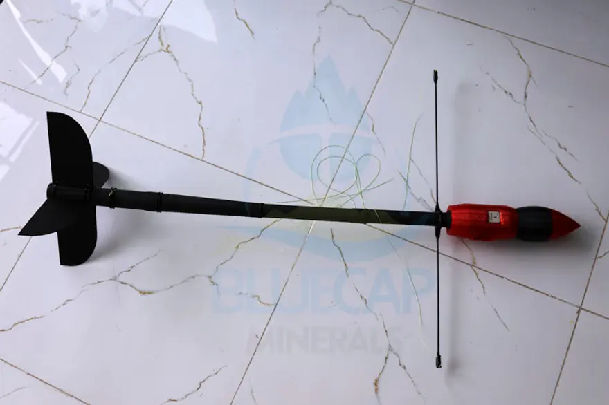
BlueCapBird® Light
Best suited to local infill, follow-up and flat open ground with low vegetation — including desert and bush terrain in Western Australia — where a lightweight electric carrier and lower survey speed are practical.
01Acquisition speed
≈3–25 m/s
02Payload mass
≈1.1 kg
03Boom
1.0 m
04Vertical control
Fixed stabilising surfaces
Four active control surfaces
02 · Large-area production
BlueCapBird® Fast
Designed for long line-kilometres, steep downhill profiles and large survey areas where aerodynamic downward authority and BlueCapWinch® work together.
01Acquisition speed
10–40 m/s
02Payload mass
≈1.9 kg
03Boom
1.2 m
04Vertical control
Four active surfaces
VS
Reference architecturesVisual comparison
See the systems before comparing the claims
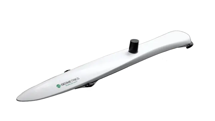
Clients compare complete airborne systems, not sensor names in isolation. These four photographs identify the architectures discussed below — passive suspended bodies, a rigid carrier-mounted array and BlueCap's actively controlled suspended system.
Market reference
01 · Passive suspended body
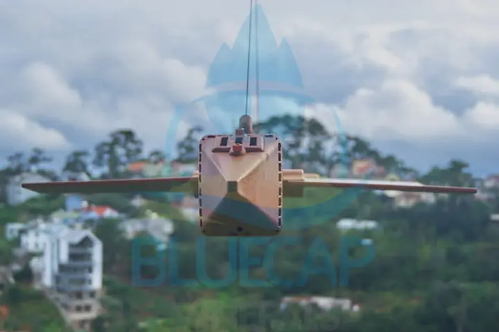
MagArrow II
Dual MFAM caesium sensing with onboard GPS and storage in a lightweight passive aerodynamic body.
Market reference
02 · Passive towed body
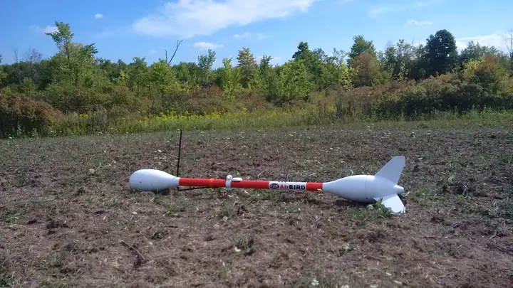
GEM AirBIRD
Long passive bird with a scalar magnetometer, onboard flight channels and local RadioLink to GEMDAS.
Market reference
03 · Rigid carrier-mounted array
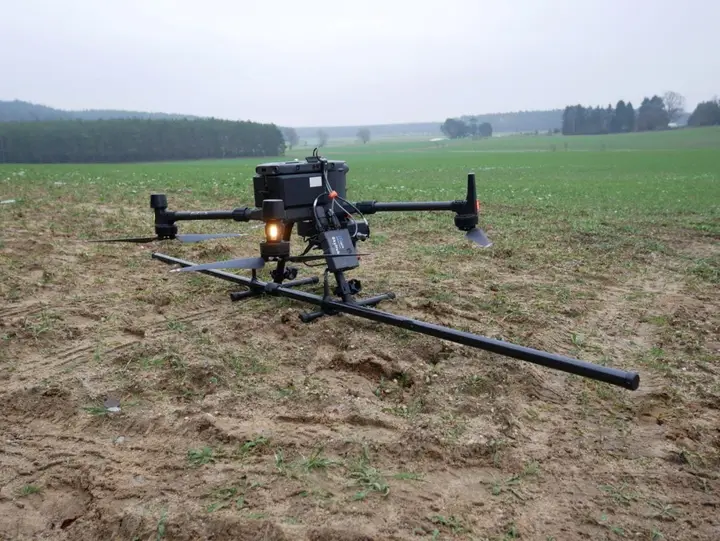
SENSYS MagDrone R4
Rigid fluxgate-boom system whose vertical path follows the carrier's own climb and descent manoeuvre.
BlueCap integrated system
04 · Active suspended body
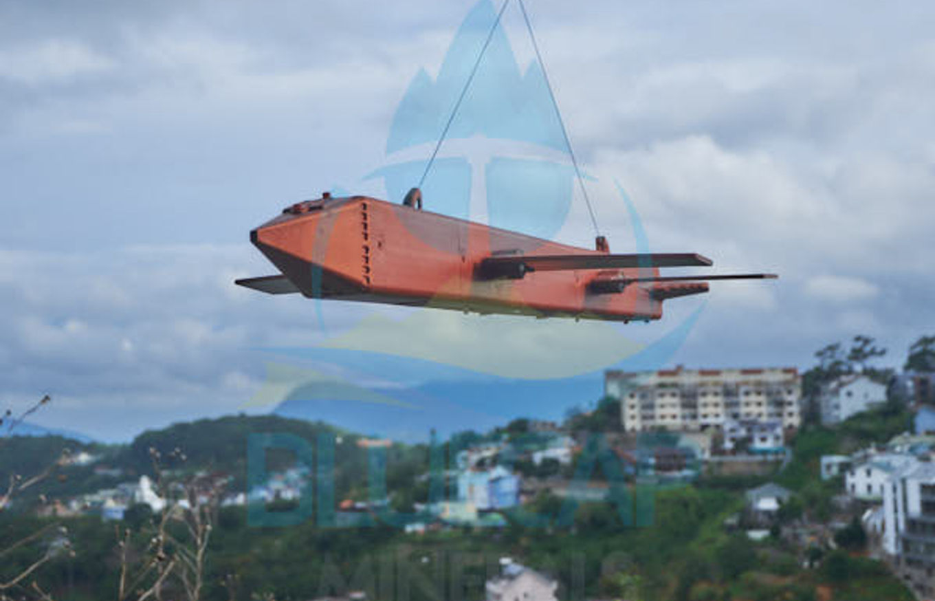
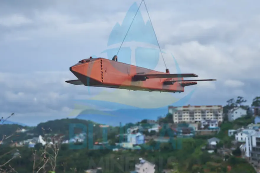
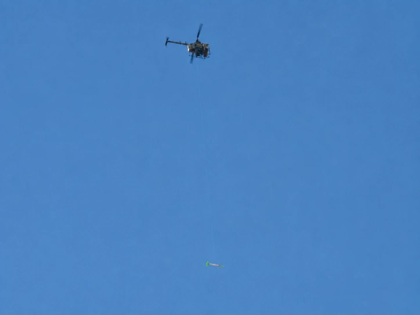
BlueCapBird® Fast
QuSpin QTFM sensing with active descent surfaces, independent Range LiDAR, fused RTK positioning and a protected server-side record.
Problem-led engineering01
Four survey problems the payload specification alone cannot solve
Commercial systems make different choices about sensor placement, sensing physics and data handling. BlueCapBird® starts with the failure each choice can create in a real survey, then we integrate the hardware and workflow needed to control that risk in a BlueCap survey.
01 · Magnetic cleanliness
Keep the carrier out of the geology
Survey problem
A highly sensitive magnetometer measures every nearby magnetic field — not only the geology below. The batteries themselves, their cell cans and tabs, wiring, electronics, motors and the carrier all add platform noise. In conventional magnetometer assemblies, that noise can merge with small, weak anomalies and remove usable detail before processing begins. Post-processing cannot recreate a geological signal once it has been buried inside platform noise.
BlueCap engineering
BlueCap places the QTFM at least 20 m below BlueCapHeli®, limits the complete bird to just 12.2 g of metal, keeps electronics and power more than one metre from the sensor and uses certified fully non-magnetic Li-ion cells.
Client gain
The client receives a higher-detail magnetic dataset with weak, compact anomalies still visible for interpretation and targeting. These weak responses can be the only surface expression of a deeper magnetic source. Preserving them gives the exploration team a more defensible picture of where drilling is supported — and where an unnecessary hole should be avoided.
02 · Terrain productivity
Hold target sensor height without slowing the survey
Survey problem
MagArrow II and GEM AirBIRD have no active control surfaces; rigidly mounted SENSYS MagDrone must follow every vertical drone manoeuvre. On steep descents, these architectures can force the carrier from approximately 15 m/s towards 5 m/s while sensor height above terrain still repeatedly leaves its target AGL corridor, with field-observed height errors reaching 5–6 m. Daily line production then falls sharply and the survey becomes economically inefficient.
BlueCap engineering
BlueCap selects Light for approximately 3–25 m/s detail or Fast for approximately 10–40 m/s production, then coordinates the BlueCapHeli® manoeuvre, motorised BlueCapWinch® and Fast's four active non-magnetic surfaces. An independent 120 m Range LiDAR measures the magnetometer's actual ground clearance.
The client gets lower sensor-height error without sacrificing field productivity — the terrain-controlled, production-scale magnetic result mineral exploration teams expect in 2026. The measured improvement depends on relief and is compared with the slowed electric-multicopter profile. This combination of control and production is one reason a suitable BlueCap survey can sometimes cost around half as much as a competing service.
03 · Real-time QC
See bad lines in real time — before demobilisation
Survey problem
MagArrow II and SENSYS MagDrone centre their standard workflows on onboard recording and subsequent download. GEM AirBIRD can radio data to a range-bound local field computer, but that feed stops at GEMDAS rather than continuing into a protected server workspace available to the client at any distance. With local-only or post-flight review, a gap, disturbance or degraded line may be discovered only after the opportunity to re-fly it has passed.
BlueCap engineering
BlueCap delivers the airborne QTFM, independent Range LiDAR, fused GNSS and RTK position, attitude, telemetry and separate same-model QTFM ground station through encrypted internet links to the secure server in real time at 60 Hz. Automated algorithms analyse the combined stream while office-based BlueCap and authorised client geophysicists inspect it from any distance, so the field crew can correct or re-fly an acquisition error before leaving site.
Client gain
The exploration team receives a field-qualified, more complete set of magnetic lines with fewer hidden gaps and a lower risk of a second mobilisation. Coverage, raw and filtered line behaviour, reference variation, 3D KML and heatmaps are available sooner for magnetic gridding, target ranking and drill planning.
04 · Data custody
Let pilots fly the survey, not take the client's data
Survey problem
MagArrow II, GEM AirBIRD and SENSYS MagDrone workflows can leave survey data on a removable card, onboard storage or a client-readable field file. Anyone with physical access may then have an opportunity to copy the paid magnetic dataset before the client receives it. This is a real chain-of-custody risk in contractor-operated surveys, not only an IT policy question.
BlueCap engineering
BlueCapBird® does not retain the client's survey as a downloadable dataset on the bird. Measurements move immediately through encrypted communications into BlueCap's server-side big-data environment, with protected transit handling if connectivity is interrupted.
Client gain
Authorised client users see their project through the secure BlueCap Survey Portal. Pilots and other field personnel can operate and monitor acquisition without receiving permission to extract, duplicate or distribute the client's magnetic map.
Quantum total-field sensing03
Sensitivity is wasted if the payload measures itself
Better than 3 pT/√Hz is the practical BlueCap balance for drone magnetic acquisition at 25–50 m AGL. It keeps intrinsic sensor noise below the important field signals without pretending that a smaller standalone instrument figure automatically produces a better magnetic map. BlueCap uses QTFM free induction decay for scalar total magnetic-field magnitude, removes avoidable magnetic material and verifies the complete assembled system in flight.
Magnetic cleanliness12.2 gmetal in the complete assembly
QTFM sensor>1 m separationelectronics · battery · wiring
Certified fully non-magnetic Li-ion cellsStandard Li-ion packs and power-bank assemblies can contain magnetic cell cans, tabs, interconnects and electronics that distort a sensitive total-field measurement. BlueCapBird® removes that avoidable source at cell level.
The remaining metal is limited mainly to wiring and electronics positioned more than one metre from the sensor head. Heading sweeps and complete-system QC still verify the complete field configuration.
<3 pT/√Hz
field-balanced sensitivity
A 5 pT/√Hz sensor brings materially more intrinsic noise. A 0.2 pT figure stated at 1 Hz is more sensitive as an instrument specification, but it is not directly equivalent and does not make a real airborne line five times cleaner. BlueCap uses QTFM below 3 pT/√Hz, then verifies achieved noise in the complete survey configuration.
±7°
single axial dead-zone cone
Readings inside the cone are automatically flagged invalid and resume when the sensor moves outside it.
Scalar
total-field measurement
Magnetic-field magnitude is recorded while position, altitude, heading and telemetry remain separate synchronised channels.
60 Hz
connected field stream
Airborne and ground-reference magnetic data enter the same project workspace for preview and processing.
Terrain-hugging geometry04
Passive birds make the aircraft slow down for terrain
MagArrow II, GEM AirBIRD and other passively suspended sensors cannot command their own descent. As terrain falls away, a conventional electric multicopter profile may slow from approximately 15 m/s towards 5 m/s to keep the bird near target AGL. BlueCap shares that vertical work between BlueCapWinch®, the helicopter manoeuvre and Fast's four active surfaces so production can remain closer to 40 m/s.
BlueCapBird® Fast · active aerodynamic surfaces · BlueCapWinch® suspension
Portal trajectory review · terrain-relative altitude≥20 m magnetic separation below the carrier
≥20 m
carrier-to-sensor separation
The suspended QTFM remains at least 20 m from the BlueCapHeli® airframe to reduce carrier magnetic influence.
Up to 2×
gravity-only descent rate
Four active non-magnetic surfaces generate downforce so Fast can descend substantially faster than a passive bird falling under its own weight.
≈40 m/s
rugged-terrain target speed
The carrier can stay near production speed because the winch, aircraft manoeuvre and active bird share the vertical work.
1 m
planned height corridor
Route and speed-control algorithms hold the suspended sensor close to its modelled terrain-relative profile.
Independent height evidence
Plan inside one metre. Measure the remaining difference.
01 · Planned1 m corridor
BlueCap route and speed-control algorithms keep the suspended sensor within a one-metre height-error corridor relative to the modelled surface.
02 · Measured120 m Range LiDAR
An independent sensor-to-ground measurement records the actual clearance alongside every magnetic observation.
03 · CorrectedBanomaly ∝ 1/r³
For a compact magnetic source, anomaly amplitude changes approximately with the inverse cube of distance, so residual height error matters.
Post-processing uses the measured Range LiDAR channel to compensate residual height variation more precisely instead of assuming the planned trajectory was the exact sensor trajectory.
Passive bird · gravity and drag1×
BlueCapBird® Fast · active downforceup to 2×
MagArrow II, GEM AirBIRD and other passive birds cannot actively accelerate down a falling terrain profile. Fast deflects four non-magnetic control surfaces to generate downward aerodynamic force, helping the QTFM stay inside its AGL corridor while BlueCapHeli® continues closer to production speed.
Shared vertical work
The helicopter does not have to make every height correction alone
BlueCapWinch®Pays out or recovers suspension length as the target sensor AGL moves down or up.Carrier manoeuvreContributes the practical climb or descent that is efficient for the line and terrain.Active birdAdds aerodynamic downward authority when gravity-only descent cannot follow the terrain.
Sharing the vertical work reduces unnecessary aggressive carrier manoeuvring. That lowers the sustained load on the helicopter and avoids spending fuel only to make the aircraft reproduce a movement that the winch and active bird can perform more efficiently.
BlueCap field experiment · normalised interpretation
Drag the sensor height and watch the anomaly lose definition
Move the QuSpin QTFM Gen 2 through the 25–50 m AGL range used in BlueCap's field experiment. This explorer applies a first-order 1/r³ compact-source model against the 35 m reference; it is not the observed four-site series.
Calculated source-distance interpretation shown separately from the processed experiment. BlueCapHeli® ascended above a QTFM Gen 2 on a pre-measured 20 m suspension while the stripped tubular bird completed free yaw rotations at each height level.
Profile at 35 m sensor AGL 35 m reference profile 100% of the reference peak
25 m35 m reference50 m
Peak response vs 35 m
100%reference geometry
Width at half response
≈54 mvs ≈54 m at the reference
Synchronised field record05
Compare the complete measurement record
A magnetometer number is useful only when its noise, position, true height, motion and payload state are known on the same timeline. Each row compares reference systems with the BlueCap channel used by office-based client and BlueCap geophysicists for live QC and controlled post-processing.
Comparison of airborne magnetometer measurement records
Measurement channel
Reference systems
BlueCap integrated record
Client result
01Sensitivity versus installed noise
MagArrow II states 5 pT/√Hz typical cesium noise. GEM AirBIRD states 0.2 pT sensitivity at 1 Hz for its GSMP-35U potassium option. SENSYS MagDrone R4 uses fluxgate sensors with resolution better than 150 pT.
BlueCap selects QTFM free-induction-decay total-field sensing below 3 pT/√Hz, then validates the complete low-metal payload rather than relying on the smallest stand-alone sensor number.
Field-balanced sensitivity preserves weak geological signals without letting platform noise dominate the line.
02GNSS + RTK fusion
MagArrow II states 1.5 m GPS and up to 1.0 m with SBAS; GEM AirBIRD states 0.7 m GPS; SENSYS MagDrone can accept the drone's external GPS or RTK position.
BlueCap time-interpolates the suspended magnetometer trajectory and fuses it with BlueCapHeli® RTK, typically positioning accepted samples within 10–50 cm.
The magnetic sample receives its own fused spatial reference instead of simply inheriting a carrier coordinate.
03120 m Range LiDAR
GEM AirBIRD includes a downward laser range finder in its front pod for height tracking and post-processing, but does not state its model or range. Standard MagArrow II and SENSYS MagDrone R4 systems do not include an independent sensor-to-ground range channel.
BlueCap synchronises an independent 120 m Range LiDAR measurement with each accepted magnetic observation for QC and project-specific height modelling; no universal scalar height correction is assumed.
True magnetometer AGL is retained as an observed geometry channel instead of being inferred only from the terrain model or carrier.
04Acceleration, gyro and heading
MagArrow II records a 200 Hz accel/gyro and 100 Hz compass; GEM AirBIRD records pitch, roll and yaw for local GEMDAS display. Having an IMU alone is not unique.
BlueCap synchronises the bird's acceleration, gyro and heading with QTFM, height and position, then uses the motion record in line QC and controlled post-processing rather than merely storing or displaying it.
Office geophysicists can test whether a line feature follows geology, orientation or payload motion.
05Power, payload and flight telemetry
MagArrow II and SENSYS centre on onboard storage and local access; GEM AirBIRD sends its multi-channel view by range-bound RadioLink to a field computer running GEMDAS.
BlueCap streams voltage, current, payload health and flight state through encrypted internet links into the same server-side 60 Hz project record.
Authorised client and BlueCap geophysicists can review acquisition health securely from the office at any distance.
Stationary magnetic reference
Magnetic base station
Also calledDiurnal correction station
Records non-geological temporal field variation on the same UTC timeline as the survey lines and streams it to the BlueCap server in real time through Starlink. Geophysicists inspect this record and apply it as the diurnal correction.
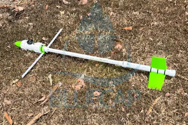
Same instrument in both roles. BlueCap uses the complete BlueCapBird® Light on the ground and suspended beneath a drone — not a different ground magnetometer.
Identical hardware
Same BlueCapBird® Light assembly and QuSpin QTFM Gen 2 sensor in airborne and stationary roles
Common time
GNSS/UTC-aligned with every accepted airborne magnetic sample
Live server stream
Recorded and sent to the BlueCap server in real time through Starlink Mini, with local continuity through an interruption and synchronisation after reconnection
Survey window
Continuous trace from before the first line until after the final line
Quiet-site control
Located near the survey block in a low-gradient position away from vehicles, generators, fences and power infrastructure
Geophysical QC
Raw and filtered traces retain spikes, dropouts, rapid diurnal change and magnetic-storm flags for line acceptance
Magnetic base stationSame QTFMDiurnal correction station · BlueCapBird® Light
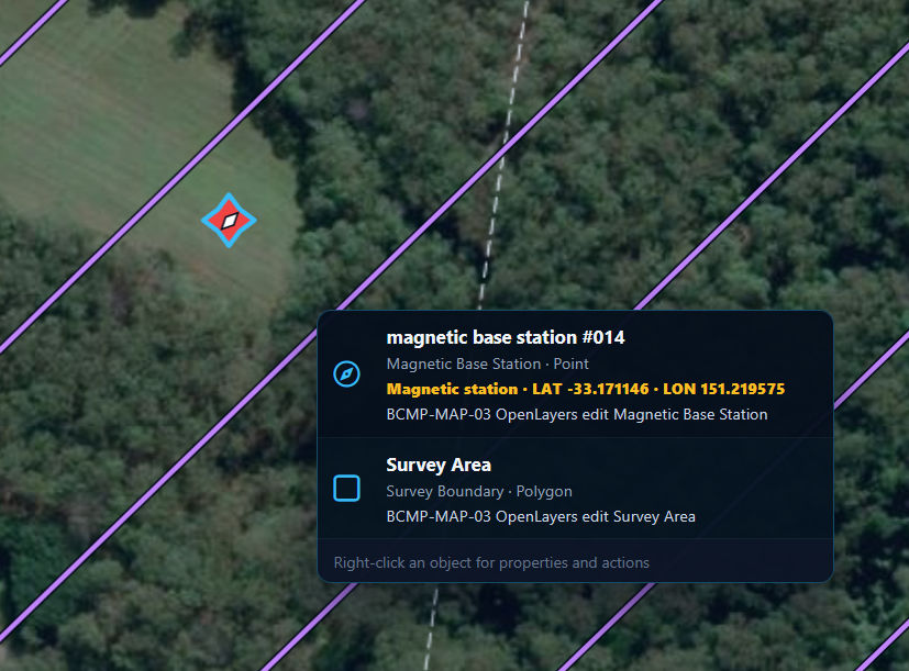
BlueCapBird® Light shown as the magnetic base station — the same complete instrument can be suspended beneath a drone.The Portal planning map stores the exact base-station point and coordinates against the approved survey lines.
One time-aligned project record
From both QTFM sensors to the office
Airborne QTFMGround QTFMServer-side big dataOffice and client QCControlled processing
No client-readable survey file remains on the bird. The encrypted link keeps flight operation and data entitlement separate: pilots can conduct and monitor acquisition, while only authorised project users can access the client's magnetic data through the secure portal.
The raw record is preserved. Automated checks can start after each flight; BlueCap geophysicists remain responsible for QC and interpretation-ready outputs.
From acquisition to decision06
Find the acquisition problem while it can still be fixed
A rejected line discovered after demobilisation costs another mobilisation or leaves a gap in the geological evidence. BlueCap makes coverage, incoming line behaviour and reference data visible during acquisition so the project team can act inside the field window.
01
Field decisions
Review coverage and incoming magnetic line data while acquisition continues, with the field team still able to respond.
02
Office-based geophysical QC
Client and BlueCap geophysicists can inspect progress, raw and filtered views, 3D KML and magnetic heatmaps without travelling to site.
03
Re-flight control
Identify gaps, degraded lines or acquisition issues before the mobilisation window closes.
04
Controlled processing
Preserve the complete raw record while automated workflows and BlueCap geophysicist QC prepare usable outputs.
Controlled handover
One traceable record. Different agreed delivery depths.
Raw recordairborne field · reference field · GNSS · altitude · attitude · telemetryProcessed datasynchronisation · diurnal workflow · filtering · gridding · QAInterpretation-ready outputsagreed maps, derivatives and technical evidence for the project team
Start with your survey area and the data you need. We’ll help define the scope, review terrain-aware 2D and 3D flight plans, and keep field progress, processed data and deliverables together in the BlueCap Survey Portal.
No software subscription fee for BlueCap service projects.
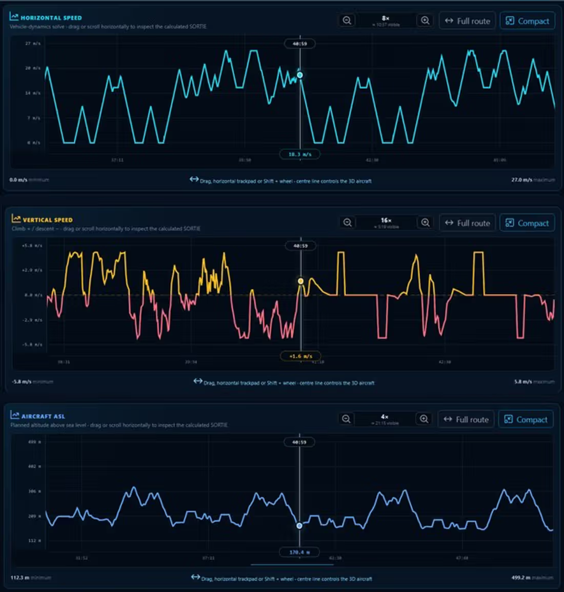
Multi-aircraft survey allocationDivide a large survey area into coordinated aircraft sorties and review the complete route geometry on the map.Quote-ready projectKeep the live scope, calculated duration, field mobilisation and current commercial position in one project record.2D route designDraw the survey area, set start and landing points, allocate aircraft and inspect the calculated flight lines.Terrain-aware 3D simulationReview the calculated mission against DEM terrain, route state and the aircraft flight projection before field deployment.Corridor and obstacle reviewInspect terrain and infrastructure clearance around the calculated aircraft and suspended-sensor trajectories.Flight-state evidenceFollow speed, vertical motion, aircraft clearance, altitude and heading within the same recorded mission.Detailed trajectory reviewReplay the route and inspect the calculated horizontal speed, vertical speed and aircraft altitude at any point.